LiDAR terrain · Updated 2026-09-30
Read elk terrain beneath the canopy.
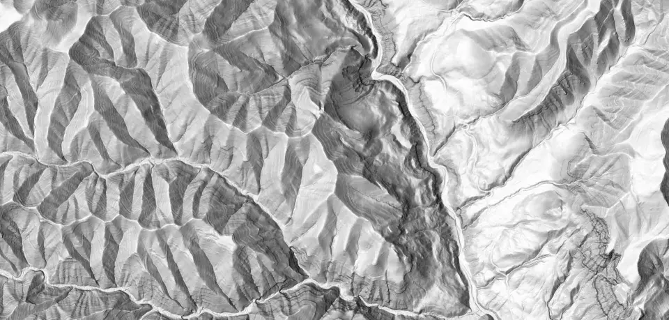
RidgeRead LiDAR maps show the bare-earth shape of the ground under tree cover. Use that shape and the cover above it together. A hidden shelf can be worth investigating even when it is hard to read on satellite imagery.
Free includes 3 analyses per month. Pro Monthly is $4.99/month. See current plans and annual availability.
Inspect the terrain example · Watch the terrain lesson · Download RidgeRead
Best for
- Finding subtle benches, cuts and old grades.
- Comparing ground shape with visible canopy and openings.
- Checking the terrain around a proposed approach.
Not for
- Seeing animals beneath trees.
- Inferring current cover, access or elk occupancy from elevation alone.
A bench worth checking, not a bedding guarantee
Our precomputed Montana example includes an 11.4° northeast-facing shelf within a sidehill averaging 20°. Compare that shelf with the nearby saddle, then inspect cover and a legal approach. The gentler patch is a terrain observation; bedding use remains a hypothesis.
Watch the recorded walkthrough and inspect the explanation attached to each candidate. The demonstration uses prepared data, not current elk locations.
Switch between ground and cover
Bare-earth relief makes terrain easier to interpret, while satellite imagery helps you inspect visible cover and openings. Add slope and aspect when deciding whether a shelf or crossing fits your plan.
A smooth-looking route may still contain deadfall or difficult vegetation. Elevation data and imagery have different collection dates and resolutions; neither establishes present trail conditions.
Coverage and plans
LiDAR and analytical layers are Pro features. The USGS-derived basemap depends on source coverage and resolution. Check the exact area at the zoom level you need rather than assuming all base-map coverage has equivalent LiDAR detail.
If preparing offline maps, select the supported layers in the download workflow and reopen the area without connectivity before leaving.
Sources and scope
FAQs
- Does LiDAR show elk under trees?
- No. The bare-earth view represents ground shape. It does not reveal animals or establish current habitat use.
- Is detail identical everywhere?
- No. Coverage, source resolution and collection dates vary. Inspect your intended area before relying on it.