About RidgeRead · Updated 2026-10-04
RidgeRead: elk scouting maps and terrain analysis.
RidgeRead is a hunting map and terrain-analysis app for self-guided western elk hunters. It combines terrain, cover, access, pressure and seasonal context to rank places to investigate and help you plan an approach.
Free includes 3 analyses per month. Pro Monthly is $4.99/month. See current plans and annual availability.
Inspect the terrain example · Watch the terrain lesson · Download RidgeRead
Best for
- Comparing elk terrain before a trip.
- Inspecting the reasoning behind terrain candidates.
- Saving maps, waypoints and plans for field use.
Not for
- Tracking live elk locations.
- Establishing legal access or replacing official agency maps and regulations.
Who makes RidgeRead?
RidgeRead was founded by Josh Forcier and is operated by F4 Software LLC, his software company. He is a software engineer who has hunted elk for 10 years, mostly in Montana, Wyoming and Colorado, and he writes RidgeRead's scouting guides. The official product website is www.ridgeread.com. RidgeRead is available in a web browser and through its iOS and Android app listings.
Why I built RidgeRead
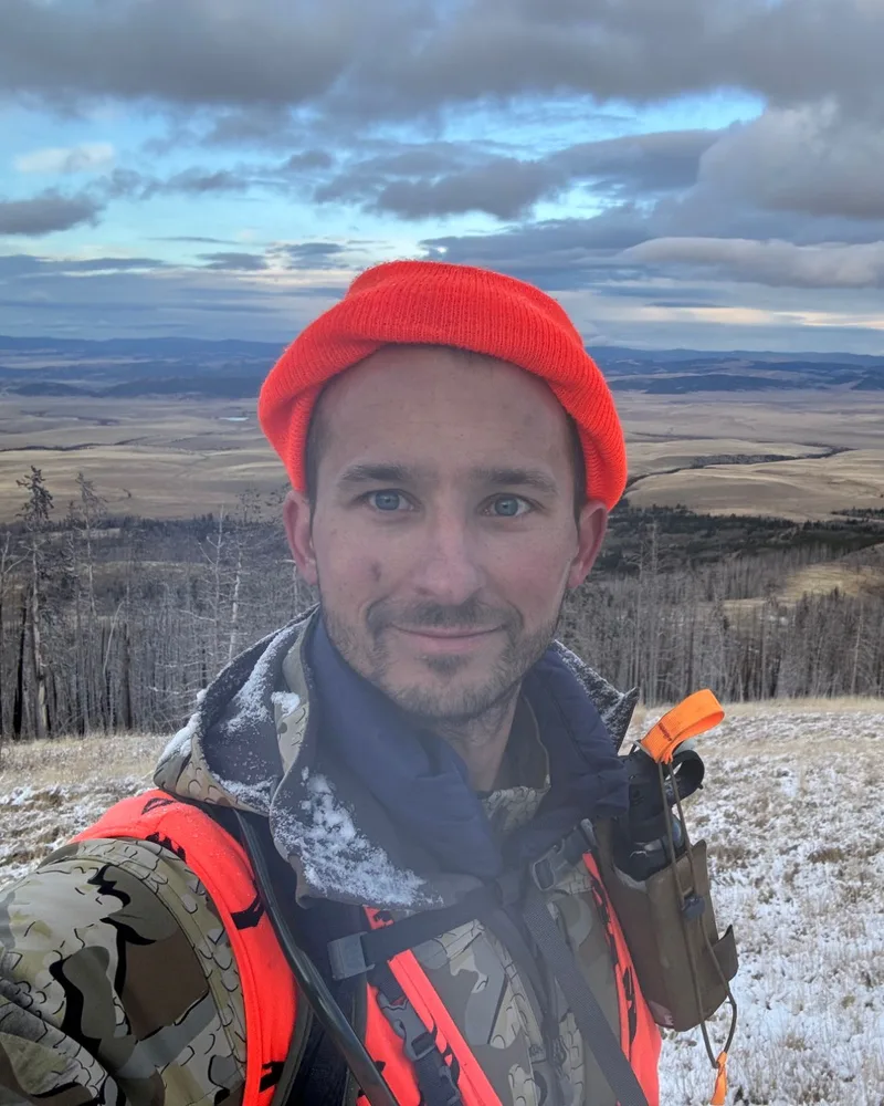
I'm Josh Forcier. I've hunted my whole life and have hunted elk for 10 years, mostly in Montana, Wyoming and Colorado. My kind of hunting is DIY backcountry elk and mule deer.
I live in Minnesota, so I don't have mountains in my backyard to scout. I've used onX Hunt since 2017 and have always liked it, but a lot of its features felt aimed at whitetail hunters. I wanted better tools for reading terrain and narrowing down areas before making the trip out West.
I'm also a software engineer, so I started building a few small tools for myself. Over time they grew into one app. Earlier in 2026 I showed a friend what I'd been working on, and he encouraged me to publish it. So I did.
I want RidgeRead to cut the time it takes to e-scout and make western hunting more accessible, without giving away spots or taking away the skill. I don't want RidgeRead to find the elk for you. I want it to help you become a better hunter.
My biggest passions are building things, elk hunting and my family. RidgeRead is where two of those meet. You can reach me at josh@ridgeread.com.
What does RidgeRead help you do?
Start with a hunting area, inspect cover and access, and compare terrain features such as benches, saddles, ridges and drainages. Ranked terrain matches include reasoning you can inspect before saving an approach.
Pro tools include LiDAR terrain, slope and aspect, terrain filtering, wind scenarios and offline planning. Satellite Habitat Evidence adds observations of greenness, seasonal change and moisture in supported areas. These tools provide different kinds of evidence; none confirms that elk are present.
What does RidgeRead cost?
Free includes 3 terrain analyses per month. Pro Monthly is $4.99 per month. The published Pro Annual price is $29.99 per year where the annual plan is offered. Current checkout or the relevant app store determines plan availability, trial eligibility, local currency and taxes.
Pro adds unlimited analyses, analytical terrain layers and offline planning. Compare the plan details before choosing a subscription.
Where does it work, and what works offline?
Base maps cover all 50 U.S. states. Individual layers, terrain scans, wind inputs and satellite evidence have different regional coverage, source dates and resolutions. Check the selected area in the app; base-map coverage does not mean every analytical tool is available there.
Download supported maps and layers before leaving connectivity, save the plan on the device, and reopen the area offline to check it. Saved weather scenarios and satellite publications retain their recorded dates; they do not become live observations while disconnected.
How can you evaluate the results?
Inspect the precomputed terrain example and watch the recorded walkthrough. Compare each candidate with cover, pressure, access and conditions on the ground. Treat terrain suitability as a reason to investigate, not as a sighting or a success prediction.
Our app comparisons use linked product documentation and disclose that method. They do not claim an independent field test or a measured GPS-accuracy ranking.
Support and privacy
For product or account questions, use RidgeRead Support or email josh@ridgeread.com. Read the privacy policy for how account, location and scouting data are handled and the terms for subscription and use details.
FAQs
- Is RidgeRead an elk hunting app?
- Yes. RidgeRead is a hunting map and terrain-analysis app focused on helping western elk hunters scout terrain, compare approaches and save field plans.
- Is RidgeRead available on iPhone and Android?
- Yes. RidgeRead has App Store and Google Play listings, and a web app at www.ridgeread.com. Use the official download page to choose a platform.
- Does RidgeRead find live elk?
- No. It identifies terrain worth investigating using available data and planning inputs. Verify elk sign, wind, current conditions and legal access in the field.
- Is RidgeRead free?
- There is a free tier with 3 analyses per month. Pro Monthly is $4.99 per month; paid plans add unlimited analyses and Pro tools. Check current checkout for annual availability and trial eligibility.